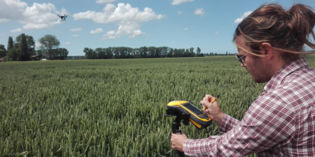
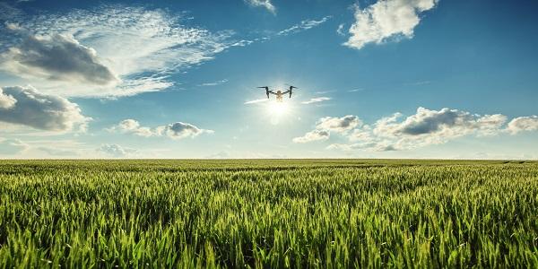
Automated image processing for drone-based phenotyping
MAPEO is a drone-based high-throughput phenotyping solution for research and breeding. Our online platform gives plant breeders, researchers, and agricultural field managers a more complete and objective view on experimental field trials of any size.
- Cost-effective and end-to-end image processing solution
- Simplify breeding and selection programmes
- Accelerate time to market
- Automate outdoor phenotyping process
- Get reliable, quantitative, and non-destructive data about all your plots
- Processed results within 24 hours
Use MAPEO for your large-scale automated trait measurements, and speed up and improve your product development process.

HIGH-THROUGHPUT PHENOTYPING ON EXPERIMENTAL FIELDS
Automated image-processing technology
MAPEO is an image-processing solution offering a set of image-processing tools.
Smart and easy to use crop analytics
- Fully automated image analytics service
- Accessible from anywhere in the world
- Temporal and spatial analytics
Multi-sensor approach
- Wide range of sensors supported: RGB - Multispectral - Thermal - Lidar - Hyperspectral - etc.
- Up to sub-millimetre resolution
CREATE A DIGITAL TWIN OF YOUR FIELD
High-quality information products
A drone-based phenotyping solution which provides several trait measurements at critical times during the growing season. Use these products to get better and faster insights in your field trials.

Generic products
- Orthomosaic, digital elevation model
Generic traits
- Height
- Lodging
- Leaf cover
- Vegetation indices
All possible vegetation indices are available:
NDVI - NDRE - MCARI - CIRededge - Cigreen - etc. - Flowering intensity
- Growth curves

Crop-specific traits
- Emergence
- Early vigo
- Stand count
- Leaf angle
- Organ / fruit count
- Flower count
- Disease detection
Fusarium - cercospora - powdery mildew - fire blight - little cherry virus - Xanthomonas fragariae, Phytophtora cactorum
FOR YOUR LARGE-SCALE, AUTOMATED TRAIT MEASUREMENTS
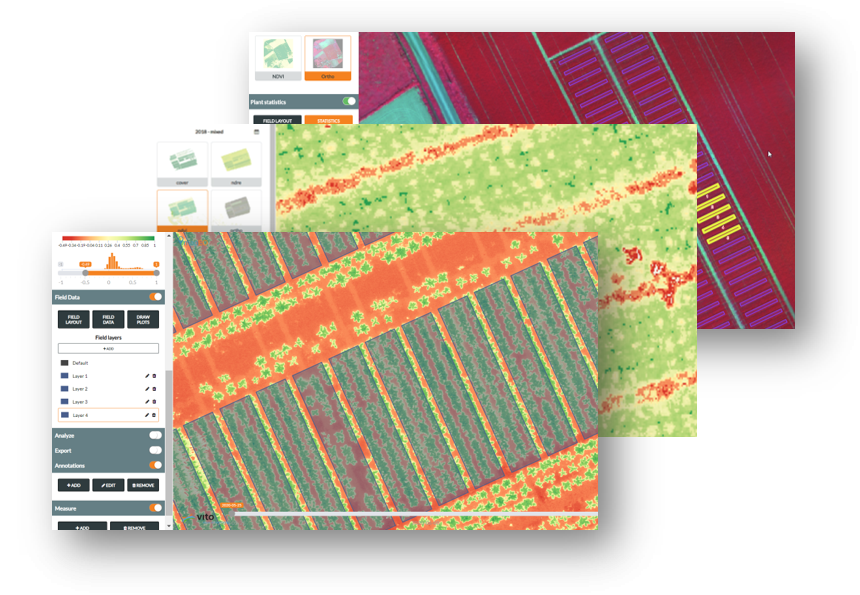
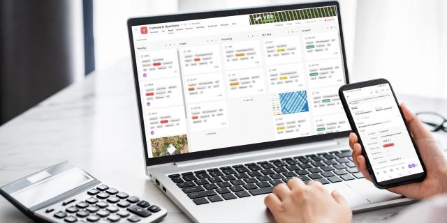
How does it work?
MAPEO is an end-to-end online platform. After creating a personal account you can easily use all available tools and services to improve your phenotyping process.

ACCELERATE TIME TO MARKET

WUR Collaboration
WAGENINGEN UNIVERSITY & RESEARCH AND VITO JOIN FORCES TO CREATE A REFERENCE PLATFORM IN DRONES-BASED RESEARCH APPLICATIONS
Technological innovation in drone-based imaging and analytics demands collaboration, scalability, and shared expertise. That’s why VITO and Wageningen University & Research are proud to announce their strategic partnership centred around the MAPEO platform, a cloud-based environment where research institutions can transform their domain knowledge into scalable digital solutions.

Enza Zaden
EMPOWERING BREEDING FOR STRIP CROPPING WITH DRONE-BASED INSIGHTS
In the quest for sustainable agriculture, innovative approaches are essential to optimize crop performance and enhance biodiversity. One such approach is strip cropping, which improves soil health, increases biodiversity, and reduces pests and disease pressure. The collaboration between VITO Remote Sensing and Enza Zaden is a prime example of leveraging advanced technology to accelerate the very much needed insights in the dynamics of strip cropping systems. Learn more in this blog post.

EMPHASIS-Belgium
MAPEO NOW PART OF PHENOTYPING RESEARCH INFRASTRUCTURE EMPHASIS-BELGIUM: RUN YOUR EXPERIMENT
MAPEO, VITO's end-to-end drone-based image processing platform for high-throughput phenotyping in agriculture and research, is now part of EMPHASIS-Belgium, the Belgian research infrastructure for plant phenotyping. Researchers and small to medium-sized enterprises who want to run an experiment on the MAPEO platform are invited to register before the end of January 2026.
BEETPHEN
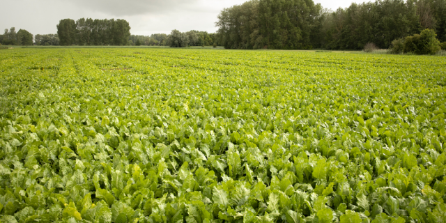
SEARCHING FOR DISEASE-RESISTANT SUGAR BEET VARIETIES USING MAPEO
Seed breeders are always in search for new, disease-resistant cultivars to help farmers grow productive and healthy crops in a sustainable way. To support this, BELSPO initiated the BEETPHEN project in which SESVanderHave, VITO Remote Sensing and CRA-w evaluated the use of hyperspectral drone imagery and innovative remote sensing technology for crop phenotyping in sugar beet breeding trials. Discover how they used MAPEO to create a digital twin of the trial fields.
SESVanderHave
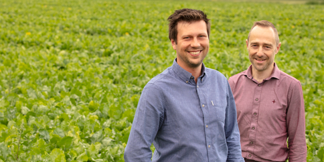
TOWARDS A MORE EFFICIENT PHENOTYPING WITH MAPEO
Multi-national sugar beet seed company SESVanderHave is breaking into remote sensing to improve their selection programmes. By monitoring its trial fields for crop breeding with drones and analysing the data via MAPEO, they are able to upscale their ‘phenotyping’ process. Maarten Vanderstukken and Jurgen Decloedt explain how drone-based phenotyping supports seed breeders and crop protection firms to speed up their cultivation and selection programmes.
OBJECT DETECTION
DEVELOPING AN OBJECT DETECTION WORKFLOW FOR DRONE IMAGERY
New and innovative machine learning technologies make it possible to implement highly accurate object detection algorithms and gain further insights into plant growth. Combine these models with various data sets and you’re all set to develop powerful, generalized predictors applicable to a range of plant phenotyping applications. Expert Sam Oswald explains more about object detection for drone imagery.
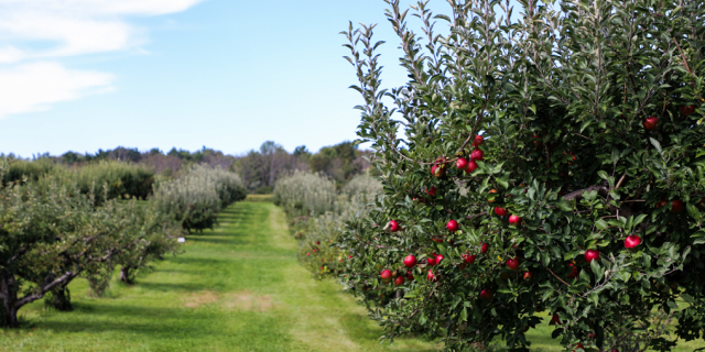
FLOWER COUNT
DRONE BASED FLOWER COUNT IN FRUIT ORCHARDS
Every fruit grower wants to obtain a rich and profitable harvest at the end of the season. Reducing the number of flowers and fruitlets early in the growing season is therefore often needed to limit the nutritional competition among fruits. Expert Stephanie Delalieux explains how VITO Remote Sensing and KU Leuven are using MAPEO to develop an automated process for detailed monitoring of flowering intensity over fruit orchards.

VLAIO COOCK - OPSDRONE PROJECT
BOOSTING DRONE-BASED SERVICES IN AGRICULTURE
Despite their large potential, drone-based services are not yet sufficiently implemented in day-to-day operations by farmers and agrifood companies in Flanders.
Within the OpsDrone project, VITO, ILVO and FlandersMake share their expertise on drones and agriculture with the sector, to speed up the investments in the drone technology. By diversifying the agrofood use-cases we ensure that technological solutions and business plans are tailored to a specific case.
DRONE MISSION MANAGEMENT
STREAMLINE YOUR DRONE OPERATIONS
Managing drone missions & analyzing the data has to be easy & flexible. Companies, governments & researchers require specific data products to serve as valuable and reliable input for their downstream operations and services.
That's why our experts continuously keep improving our end-to-end MAPEO platform to streamline data acquisition campaigns, image processing and online hosting of raw data and derived information products.
New features, including 'instant pricing', 'communication platform' and 'improved API' support users with their day-to-day drone management.
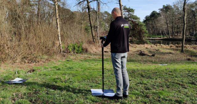
COLLECT ACCURATE DRONE DATA
DO'S AND DON'TS
Collecting drone data has evolved tremendously over the past years. We have a wide spectrum of end-to-end drone platforms, a variety of sensors and high-quality image processing tools. But there is one thing we cannot pass by: the ground control points or GCPs. GCPs guarantee the accuracy and consistency in your data products, but they obviously also complicate the drone operations quite a bit. In this blog we share the do's and don'ts related to GCPs, new features of MAPEO to make sure your data is accurate and consistent and 5 expert tips to have a successful drone data collection campaign.
High Resolution drone data
INTEGRATING & TESTING THE PHASE ONE IXM-100 MP
One of the big future trends in drone mapping for agricultural applications is the combination of high-resolution (<=1mm) imagery with powerful AI algorithms to detect specific plants or plant features like fruits, flowers or diseases.
In a recent blog, expert Dries Raymaekers explains more about the use and integration of a high resolution camera, the Phase One IXM 100 MP, its advantages and disadvantages, and three operational agricultural applications which rely on (sub)mm resolution and AI detection algorithms: disease detection in sugar beet, wheat ear detection and emergence count in lettuce.
SENSE OF FIELD PROJECT
PROTECTING AGRICULTURE AGAINST DROUGHT
It is expected that summers in Flanders will experience more and more periods of heat and drought in the coming years.
SESVanderHave has been working with VITO's remote sensing expert since 2016. With the Sense of Field project, they are looking at how the different sugar beet varieties respond to certain environmental conditions.
The study aims to protect agriculture from hot, dry summers and increase the drought tolerance of cultivated crops.
You can have a closer look at this Sense of Field project, the VITO-SESVanderHave partnership and technologies that help build a more sustainable future.
Drone operations services
Through our partnership with Sitemark, we can offer you a pilot on demand service.
Just enter the field parameters and get a quote for a drone pilot service.
In case you like to fly yourself, we can also help you selecting the right equipment for the job and get you started with the correct flight procedures that fit your needs.
Contact us in case you like more information.

Contact
VITO Remote Sensing
Boeretang 200
2400 Mol
Belgium
remotesensing.vito.be
blog.vito.be/remotesensing
----------------------
The personal data that you have shared with VITO will be stored in a secure environment that is not accessible to the public. Your personal data will not be shared with any third party. You have the right of access, to rectification and erasure (this gives you the right to be ‘forgotten’). Please contact VITO by filling out the privacy contact form. Your personal data will only be used for purposes strictly limited to VITO services. For more information read our Privacy Policy.